Property Assessments That Map Wildlife Movement
Habitat consultations in Des Moines for landowners who need specific stand locations and travel corridors identified before physical work begins
Central Iowa's mix of row crop fields and timber edges creates habitat opportunities that satellite imagery can't reveal. Badhabitz Outdoors conducts on-the-ground habitat consultations across Des Moines and surrounding properties — boots-on-the-ground assessments that identify pinch points, bedding areas, travel corridors, and stand locations based on terrain features, existing cover, and observable deer sign. Properties with transitional acreage between ag fields and timber stands benefit most, where small adjustments in clearing, planting, or access routes produce measurable changes in deer movement patterns.
The consultation process involves walking the property to locate existing travel routes marked by rubs, tracks, and bedding sign, then mapping how those patterns connect to available food sources and cover. Wind direction, access routes that avoid spooking bedded deer, and terrain funnels that don't show up on aerial maps all factor into the final recommendations.
Arrange an on-site property assessment to receive a detailed habitat blueprint before clearing, planting, or building any structures.
How Consultation Results Shape Physical Habitat Work
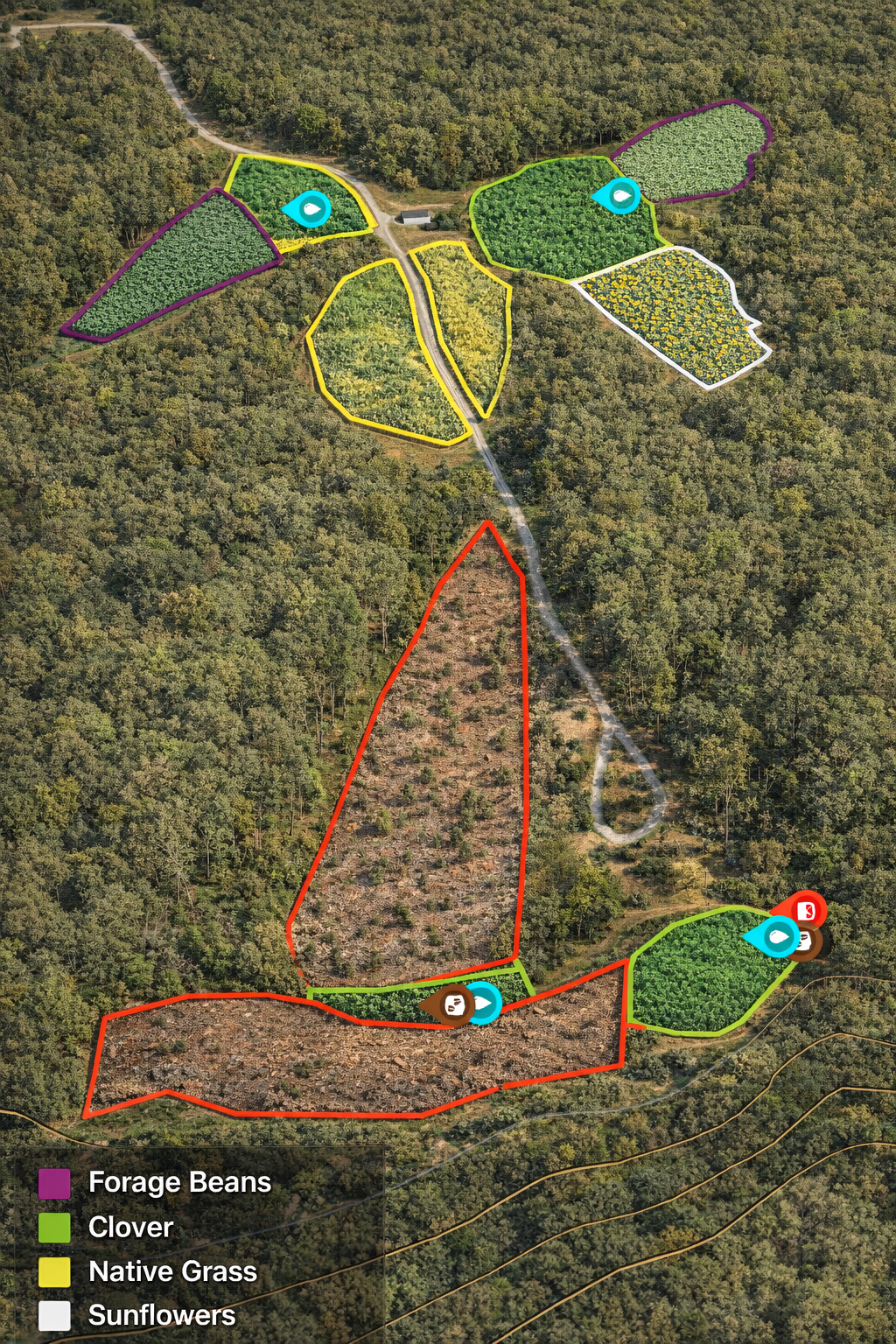
Consultation reports deliver specific coordinates for stand placements, mapped travel corridors where deer naturally move between bedding and feeding areas, and recommended food plot locations sized and positioned to match browse pressure and visibility from identified stand sites. Properties that receive consultations avoid the common mistake of clearing too much cover or planting food plots in locations deer avoid due to wind exposure or lack of staging cover nearby.
After the consultation, you'll have a written plan that documents which areas to leave untouched for bedding security, where to install screening cover for stand access, and which existing vegetation should be cleared to open sight lines or create funnels. This plan serves as the foundation for all subsequent habitat work, ensuring that forestry mulching, food plot installation, and native plantings work together rather than as isolated improvements.
Consultations also identify invasive species that need removal before planting, soil drainage issues that affect food plot site selection, and property boundary considerations that influence how deer enter and exit the parcel. The assessment is conducted by someone who hunts and manages Iowa land, not a generic wildlife checklist applied without local context.
What Property Owners Typically Want to Know
Landowners scheduling habitat consultations across the Des Moines metro area usually ask about the process itself and how the results guide future decisions.
What does the consultation involve on the day of the visit?
The process includes walking the entire property to observe deer sign, evaluate existing cover and food sources, test wind patterns from potential stand locations, and photograph key features that affect habitat decisions.
How long does a typical property consultation take?
Most consultations require two to four hours on site depending on acreage and terrain complexity, with an additional week for report preparation and mapping.
Do I receive a written report after the consultation?
You receive a detailed report that includes a property map with stand locations marked, travel corridors identified, recommended clearing zones outlined, and food plot sites selected based on the on-site assessment.
Why does Iowa habitat require different planning?
Iowa's diverse terrain requires different habitat improvement and implementation. These is determined during the on site assessment.
Can the consultation be completed in winter when vegetation is dormant?
Winter consultations often provide clearer views of terrain features and deer trails that heavy foliage obscures during growing season, making it an ideal time for initial assessments.
BadHabitz Outdoors delivers habitat plans built on actual property observation, not assumptions drawn from aerial photos or generic recommendations. Contact the office to schedule a consultation and receive a site-specific habitat strategy before committing to any physical improvements.